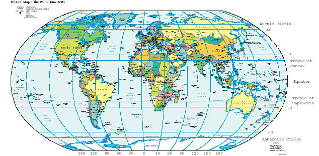
File:WorldMapLongLat-eq-circles-tropics-non.png
WorldMapLongLat-eq-circles-tropics-non.png (634 × 311 pixels, weyninka faylka : 93 KB, nuuca MIME: image/png)
Taariikhda faylka
Riix taariikhda/waqtiga si aad u argto faylka sida oo ahaa markiisa hore.
| Taariikhda/Waqtiga | Sawir yar | Cabirka | Isticmaale | Ka hadalka | |
|---|---|---|---|---|---|
| kan hadda | 12:54, 12 Nofeembar 2015 |  | 634 × 311 (93 KB) | OgreBot | (BOT): Reverting to most recent version before archival |
| 12:54, 12 Nofeembar 2015 |  | 634 × 311 (93 KB) | OgreBot | (BOT): Uploading old version of file from en.wikipedia; originally uploaded on 2004-06-09 02:02:20 by Niteowlneils | |
| 08:59, 8 Febraayo 2006 |  | 634 × 311 (93 KB) | Freshstart~commonswiki | Great circles of latitude. Originally uploaded to [http://en.wikipedia.org/wiki/Image:WorldMapLongLat-special-lats-emph-AntarcticCircle-non.png] by en:User:Niteowlneils. Based on PD image from US government. This series should have migrated to common |
Faylka lagu isticmaalay
waxyaabaha soo socda ee bog ayaa adeegsanaya faylkaan:
isticmaalka faylka aduunka
Wikisyada kale ee soosocda ayaa adeegsanaya faylka:
- Ku isticmaal ace.wikipedia.org
- Ku isticmaal af.wikipedia.org
- Ku isticmaal am.wikipedia.org
- Ku isticmaal anp.wikipedia.org
- Ku isticmaal an.wikipedia.org
- Ku isticmaal ar.wikipedia.org
- Ku isticmaal arz.wikipedia.org
- Ku isticmaal ast.wikipedia.org
- Ku isticmaal awa.wikipedia.org
- Ku isticmaal bg.wikipedia.org
- Ku isticmaal bn.wikipedia.org
- Ku isticmaal bs.wikipedia.org
- Ku isticmaal ca.wikipedia.org
- Ku isticmaal ca.wikibooks.org
- Ku isticmaal ceb.wikipedia.org
- Ku isticmaal da.wikipedia.org
- Ku isticmaal de.wikipedia.org
- Ku isticmaal dsb.wikipedia.org
- Ku isticmaal dty.wikipedia.org
- Ku isticmaal el.wikipedia.org
- Ku isticmaal en.wikipedia.org
- Ku isticmaal en.wikibooks.org
- Ku isticmaal en.wikiversity.org
- Ku isticmaal en.wiktionary.org
- Ku isticmaal eo.wikipedia.org
- Ku isticmaal es.wikipedia.org
- Ku isticmaal eu.wikipedia.org
View more global usage of this file.


