File:Map of Tennessee highlighting Davidson County.svg

Size of this PNG preview of this SVG file: 800 × 196 pixels. Waxyaabaha kale xalinta: 320 × 78 pixels | 640 × 157 pixels | 1,024 × 251 pixels | 1,280 × 314 pixels | 2,560 × 628 pixels | 7,814 × 1,916 pixels.
Faylka asalka ah (SVG file, nominally 7,814 × 1,916 pixels, file size: 98 KB)
Qoraal kooban
| Sharaxaad |
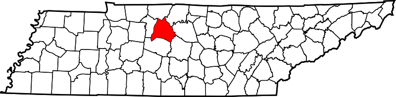
English: This is a locator map showing Davidson County in Tennessee. For more information, see Commons:United States county locator maps. |
| Taariikhda | |
| Xigasho |
Shaqadayda: English: The maps use data from nationalatlas.gov, specifically countyp020.tar.gz on the Raw Data Download page. The maps also use state outline data from statesp020.tar.gz. The Florida maps use hydrogm020.tar.gz to display Lake Okeechobee. |
| Qoraa | David Benbennick |
Laysinka
| I, the copyright holder of this work, release this work into the public domain. This applies worldwide. In some countries this may not be legally possible; if so: I grant anyone the right to use this work for any purpose, without any conditions, unless such conditions are required by law. |
| Annotations | This image is annotated: View the annotations at Commons |
Taariikhda faylka
Riix taariikhda/waqtiga si aad u argto faylka sida oo ahaa markiisa hore.
| Taariikhda/Waqtiga | Sawir yar | Cabirka | Isticmaale | Ka hadalka | |
|---|---|---|---|---|---|
| kan hadda | 16:31, 12 Febraayo 2006 | 7,814 × 1,916 (98 KB) | David Benbennick | {{subst:User:Dbenbenn/clm|county=Davidson County|state=Tennessee|type=county}} |
Faylka lagu isticmaalay
Ma jiraan bogag adeegsanaya faylkaan.
isticmaalka faylka aduunka
Wikisyada kale ee soosocda ayaa adeegsanaya faylka:
- Ku isticmaal ar.wikipedia.org
- Ku isticmaal bg.wikipedia.org
- Ku isticmaal bpy.wikipedia.org
- Ku isticmaal ca.wikipedia.org
- Ku isticmaal cdo.wikipedia.org
- Ku isticmaal ceb.wikipedia.org
- Ku isticmaal ce.wikipedia.org
- Ku isticmaal ckb.wikipedia.org
- Ku isticmaal cy.wikipedia.org
- Ku isticmaal de.wikipedia.org
- Ku isticmaal en.wikipedia.org
- Nashville, Tennessee
- Davidson County, Tennessee
- Belle Meade, Tennessee
- Berry Hill, Tennessee
- Forest Hills, Tennessee
- Lakewood, Tennessee
- Oak Hill, Tennessee
- Goodlettsville, Tennessee
- Ridgetop, Tennessee
- Spring Hill Cemetery (Nashville, Tennessee)
- Nashville-Davidson (balance), Tennessee
- Battle of Nashville
- Antioch, Tennessee
- Bellevue, Tennessee
- Madison, Tennessee
- Green Hills, Nashville, Tennessee
- Donelson, Tennessee
- Joelton, Tennessee
- Ezell Park
- Pasquo, Tennessee
- Neely's Bend
- Old Hickory, Tennessee
- Hermitage Arboretum
View more global usage of this file.