File:Laos ricefields.JPG

Cabirka muuqaalkaan: 800 × 600 pixels. Waxyaabaha kale xalinta: 320 × 240 pixels | 640 × 480 pixels | 1,024 × 768 pixels | 1,280 × 960 pixels | 2,560 × 1,920 pixels | 3,264 × 2,448 pixels.
Faylka asalka ah (3,264 × 2,448 pixels, weyninka faylka : 4.1 MB, nuuca MIME: image/jpeg)
| Camera location | | View this and other nearby images on: OpenStreetMap |
|---|
Qoraal kooban
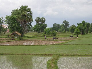
| Sharaxaad | Ricefield on Don Det, Laos |
| Taariikhda | 5 Juun 2009 |
| Xigasho | Photo taken by author |
| Qoraa | Gorgo |
| Ogolaasho (Dib u isticmaalka faylkaan) |
Released in Wikimedia Commons under PD by author. |
Laysinka
If you use this image outside of projects of the Wikimedia Foundation attribution to Wikimedia Commons or another project of the Wikimedia Foundation is appreciated.
| I, the copyright holder of this work, release this work into the public domain. This applies worldwide. In some countries this may not be legally possible; if so: I grant anyone the right to use this work for any purpose, without any conditions, unless such conditions are required by law. |
Taariikhda faylka
Riix taariikhda/waqtiga si aad u argto faylka sida oo ahaa markiisa hore.
| Taariikhda/Waqtiga | Sawir yar | Cabirka | Isticmaale | Ka hadalka | |
|---|---|---|---|---|---|
| kan hadda | 12:29, 19 Agoosto 2009 | | 3,264 × 2,448 (4.1 MB) | Gorgo | {{User:Gorgo/byme|Ricefield on Don Det, Laos|05. Jun 2005}} Category:Don Det Island |
Faylka lagu isticmaalay
waxyaabaha soo socda ee bog ayaa adeegsanaya faylkaan:
isticmaalka faylka aduunka
Wikisyada kale ee soosocda ayaa adeegsanaya faylka:
- Ku isticmaal ar.wikipedia.org
- Ku isticmaal as.wikipedia.org
- Ku isticmaal cs.wikipedia.org
- Ku isticmaal el.wikipedia.org
- Ku isticmaal en.wikipedia.org
- Ku isticmaal incubator.wikimedia.org
- Ku isticmaal mn.wikipedia.org
- Ku isticmaal my.wikipedia.org
- Ku isticmaal te.wikipedia.org
- Ku isticmaal tr.wikipedia.org