File:IGI1908MadrasTown2(1).jpg
Faylka asalka ah (954 × 1,200 pixels, weyninka faylka : 296 KB, nuuca MIME: image/jpeg)
| Sifayn |
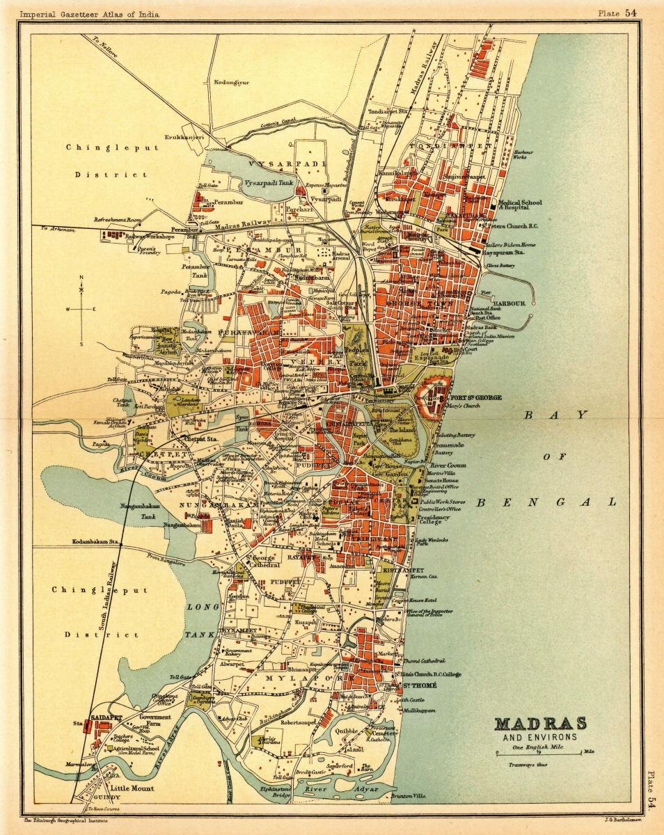
Map of the presidency town of Madras from Imperial Gazetteer of India, volume 26, Atlas, Oxford University Press. 1908. Scanned from personal copy, reduced, and uploaded by Fowler&fowler«Talk» 21:49, 7 March 2009 (UTC) |
|||||||||
| Taariikhda | ||||||||||
| Xigasho | Imperial Gazetteer of India, volume 26, Atlas, Oxford University Press. 1908. | |||||||||
| Creator |
J. G. Bartholomew, Edinburgh |
|||||||||
| Ogolaasho (Dib u isticmaalka faylkaan) |
|
|||||||||
| Geotemporal data | ||||||||||
| Bounding box |
|
|||||||||
| Georeferencing | ||||||||||

.jpg)
Taariikhda faylka
Riix taariikhda/waqtiga si aad u argto faylka sida oo ahaa markiisa hore.
| Taariikhda/Waqtiga | Sawir yar | Cabirka | Isticmaale | Ka hadalka | |
|---|---|---|---|---|---|
| kan hadda | 23:55, 1 Maaj 2011 | | 954 × 1,200 (296 KB) | MALLUS | {{Information |Description=Map of the presidency town of Madras from ''Imperial Gazetteer of India'', volume 26, Atlas, Oxford University Press. 1908. Scanned from personal copy, reduced, and uploaded by [[User:Fowler&fowler|<font color="#B8860B">Fo |
Faylka lagu isticmaalay
Ma jiraan bogag adeegsanaya faylkaan.
isticmaalka faylka aduunka
Wikisyada kale ee soosocda ayaa adeegsanaya faylka:
- Ku isticmaal ca.wikipedia.org
- Ku isticmaal de.wikipedia.org
- Ku isticmaal en.wikipedia.org
- Ku isticmaal es.wikipedia.org
- Ku isticmaal hi.wikipedia.org
- Ku isticmaal id.wikipedia.org
- Ku isticmaal it.wikipedia.org
- Ku isticmaal ne.wikipedia.org
- Ku isticmaal pt.wikipedia.org
- Ku isticmaal ta.wikipedia.org
- Ku isticmaal te.wikipedia.org
.jpg)