File:Ghurids1200.png
Cabirka muuqaalkaan: 800 × 467 pixels. Waxyaabaha kale xalinta: 320 × 187 pixels | 640 × 373 pixels | 1,024 × 597 pixels | 1,644 × 959 pixels.
Faylka asalka ah (1,644 × 959 pixels, weyninka faylka : 28 KB, nuuca MIME: image/png)
Qoraal kooban
| Sharaxaad |
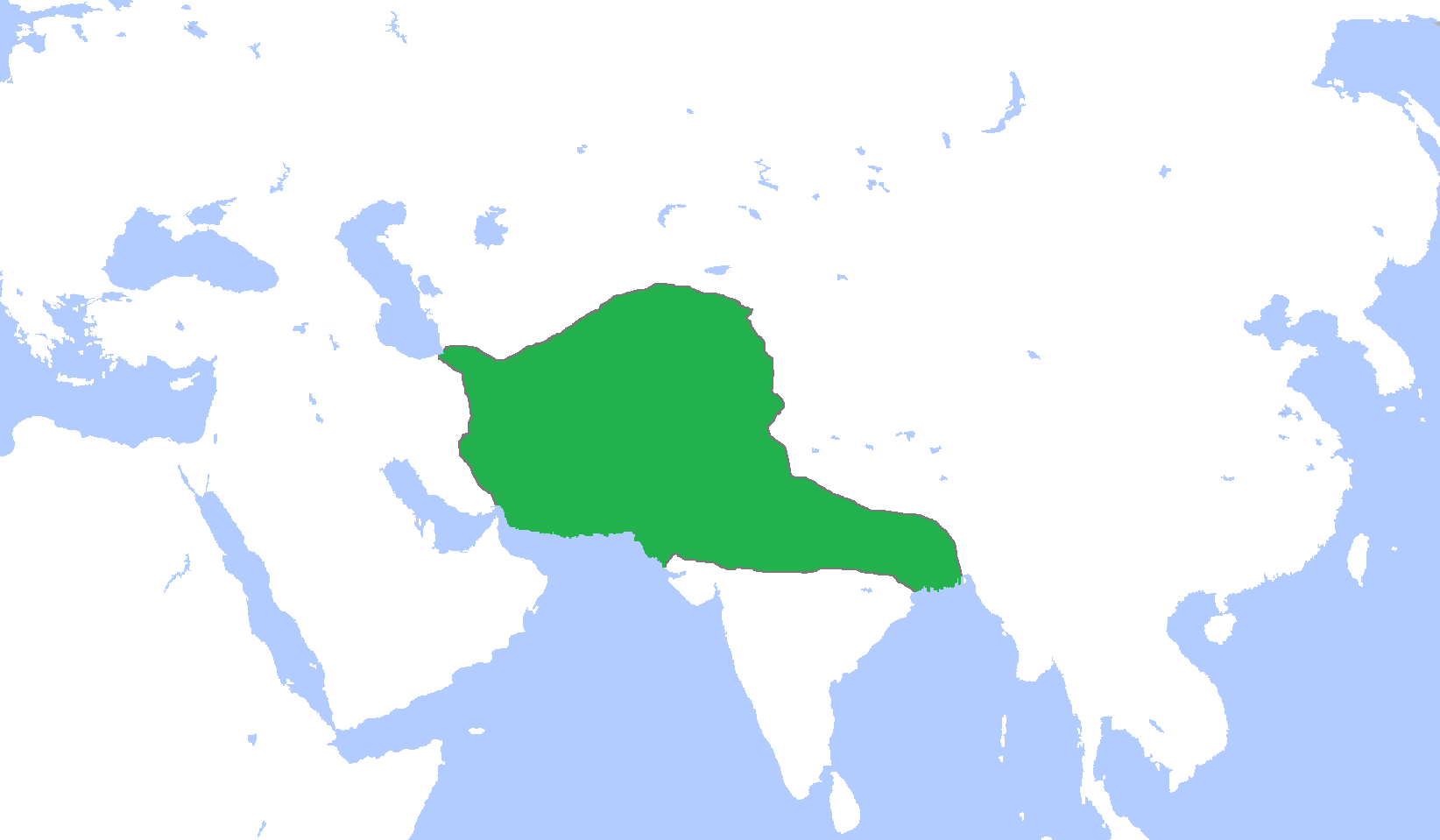
English: Locator map of the Ghurid Empire, c. 1200.
(Partially based on Atlas of World History (2007) - The World 1000-1200, map) |
| Taariikhda | |
| Xigasho | Shaqadayda |
| Qoraa | Gabagool |
Laysinka
I, the copyright holder of this work, hereby publish it under the following license:
This file is licensed under the Creative Commons Attribution 3.0 Unported license.
- Waad fasaxantahay:
- la wadaagid – koobi gareenta, qaybinta iyo gudbinta shaqada
- to remix – in shaqada la waafajiyo
- Shuruudaha soo socda:
- Astaan – You must give appropriate credit, provide a link to the license, and indicate if changes were made. You may do so in any reasonable manner, but not in any way that suggests the licensor endorses you or your use.
Taariikhda faylka
Riix taariikhda/waqtiga si aad u argto faylka sida oo ahaa markiisa hore.
| Taariikhda/Waqtiga | Sawir yar | Cabirka | Isticmaale | Ka hadalka | |
|---|---|---|---|---|---|
| kan hadda | 16:06, 9 Jannaayo 2014 | | 1,644 × 959 (28 KB) | HistoryofIran | Added the domains of the Bamiyan branch. |
| 15:35, 29 Diseembar 2013 |  | 1,644 × 959 (28 KB) | HistoryofIran | Fixed. | |
| 12:00, 29 Diseembar 2013 |  | 1,644 × 959 (28 KB) | HistoryofIran | Made the map more accurate. | |
| 12:57, 18 Juun 2013 |  | 1,644 × 959 (28 KB) | HistoryofIran | ||
| 15:32, 24 Abriil 2009 |  | 1,644 × 959 (53 KB) | Gabagool | {{Information |Description={{en|1=Locator map of the Ghurid Empire, c. 1200. (Partially based on ''Atlas of World History'' (2007) - The World 1000-1200, map)}} |Source=Own work by uploader |Author=Gabagool / Jarle Grøhn |Date=2009-04- |
Faylka lagu isticmaalay
waxyaabaha soo socda ee bog ayaa adeegsanaya faylkaan:
isticmaalka faylka aduunka
Wikisyada kale ee soosocda ayaa adeegsanaya faylka:
- Ku isticmaal ar.wikipedia.org
- الدولة الغزنوية
- غوريون
- نيسابور
- غزنة
- باميان
- ولاية غور
- محمد الغوري
- قالب:غوريون
- مستخدم:محمد رشاد ابوالنجا/Spread of Islam
- أبو علي بن محمد
- محمد بن سوري
- أمير سوري
- عباس بن شيت
- محمد بن عباس
- قطب الدين حسن
- عز الدين حسين
- سيف الدين سوري
- بهاء الدين سام الأول
- علاء الدين حسين
- غياث الدين محمد
- بهاء الدين سام الثالث
- غياث الدين محمود
- Ku isticmaal arz.wikipedia.org
- Ku isticmaal av.wikipedia.org
- Ku isticmaal azb.wikipedia.org
- Ku isticmaal az.wikipedia.org
- Ku isticmaal ba.wikipedia.org
- Ku isticmaal bn.wikipedia.org
- Ku isticmaal ca.wikipedia.org
- Ku isticmaal ceb.wikipedia.org
- Ku isticmaal cv.wikipedia.org
- Ku isticmaal da.wikipedia.org
- Ku isticmaal de.wikipedia.org
- Ku isticmaal en.wikipedia.org
View more global usage of this file.