File:Central Asia (orthographic projection).svg

Size of this PNG preview of this SVG file: 553 × 553 pixels. Waxyaabaha kale xalinta: 240 × 240 pixels | 480 × 480 pixels | 768 × 768 pixels | 1,024 × 1,024 pixels | 2,048 × 2,048 pixels.
Faylka asalka ah (SVG file, nominally 553 × 553 pixels, file size: 344 KB)
Qoraal kooban
| Sharaxaad |
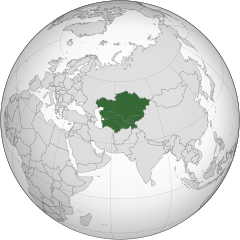
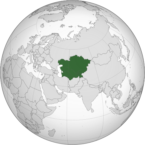
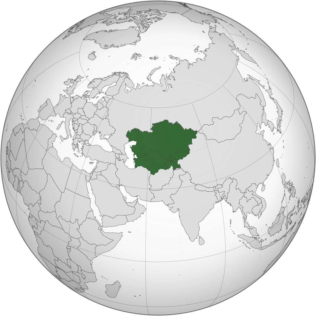
English: Central Asia with national borders Español: Asia Central con bordes |
| Taariikhda | |
| Xigasho | Iran (orthographic projection).svg |
| Qoraa | Serg!o |
| Other versions |
.svg) |
| SVG genesis |
.svg)
.svg)
.svg)
.svg)
.svg)
.svg)
.svg)
.svg)
.svg)
.svg)
.svg)
.svg)
.svg)
.svg)
.svg)
.svg)
.svg)
.svg)
.svg)
.svg)
.svg)
.svg)
.svg)
.svg)
.svg)
.svg)
.svg)
.svg)
.svg)
.svg)
.svg)
.svg)
.svg)
.svg)
.svg)
.svg)
.svg)
.svg)
.svg)
.svg)
.svg)
.svg)
.svg)
.svg)
.svg)
.svg)
.svg)
.svg)
.svg)
.svg)
.svg)
.svg)
.svg)
.svg)
.svg)
.svg)
.svg)
.svg)
.svg)
.svg)
.svg)
.svg)
.svg)
.svg)
.svg)
.svg)
.svg)
.svg)
.svg)
.svg)
.svg)
.svg)
.svg)

.svg)

.svg)

.svg)
.svg)
.svg)
.svg)
.svg)
.svg)
.svg)


.svg)
.svg)
.svg)
.svg)
.svg)
.svg)
.svg)

.svg)
.svg)
.svg)
.svg)
.svg)
.svg)
.svg)
.svg)
.svg)

.svg)
.svg)
.svg)
.svg)
.svg)
.svg)
.svg)
_without_national_boundaries.svg)
.svg)
.svg)
.svg)
.svg)
.svg)
.svg)

.svg)
.svg)
.png)
.svg)
.svg)
.svg)
.svg)

.svg)
.svg)
.svg)
.svg)
.svg)
.svg)
.svg)
.svg)
.svg)
.svg)
.svg)

.svg)
.svg)
.svg)
.svg)
.svg)
.svg)
.svg)
.svg)
.svg)

.svg)
.svg)

.svg)
.svg)
.svg)
.svg)
.svg)
.svg)
.svg)
.svg)
.svg)
.svg)
.svg)
.svg)
.svg)
.svg)
.svg)
.svg)
.svg)
.svg)
.svg)
.svg)
.svg)
.svg)
.svg)
.svg)
.svg)
.svg)
.svg)
_-_Crimea_disputed.svg)
.svg)
.svg)
.svg)
.svg)
.svg)
.svg)
.svg)
.svg)
.svg)
.svg)
.svg)
_political.svg)
.svg)
.svg)
.svg)
.svg)
_-_Crimea_disputed_-_no_borders.svg)
.svg)
.svg)
.svg)
.svg)
.svg)
.svg)
.svg)
.svg)
.svg)
.svg)
.svg)

.svg)
.svg)
.svg)

.png)
.svg)
.svg)
.svg)
.svg)
.svg)
.svg)
.svg)
.svg)
.svg)
.svg)
.svg)
.svg)
.svg)
.svg)
.svg)
.svg)
.svg)
.svg)
.svg)
.svg)
.svg)
.svg)
.svg)
.svg)
.svg)
.svg)
.svg)
.svg)
.svg)
.svg)
.svg)
.svg)
.svg)
.svg)
.png)
.svg)
.svg)
.svg)
_(orthographic_projection).png)
.svg)
Laysinka
I, the copyright holder of this work, hereby publish it under the following licenses:
This file is licensed under the Creative Commons Attribution-Share Alike 3.0 Unported license.
- Waad fasaxantahay:
- la wadaagid – koobi gareenta, qaybinta iyo gudbinta shaqada
- to remix – in shaqada la waafajiyo
- Shuruudaha soo socda:
- Astaan – You must give appropriate credit, provide a link to the license, and indicate if changes were made. You may do so in any reasonable manner, but not in any way that suggests the licensor endorses you or your use.
- si isku mid la wadaag – If you remix, transform, or build upon the material, you must distribute your contributions under the same or compatible license as the original.

|
Permission is granted to copy, distribute and/or modify this document under the terms of the GNU Free Documentation License, Version 1.2 or any later version published by the Free Software Foundation; with no Invariant Sections, no Front-Cover Texts, and no Back-Cover Texts. A copy of the license is included in the section entitled GNU Free Documentation License. |
You may select the license of your choice.
Taariikhda faylka
Riix taariikhda/waqtiga si aad u argto faylka sida oo ahaa markiisa hore.
.svg&dir=prev)
.svg&offset=20130804183708)
.svg&offset=&limit=20)
.svg&offset=&limit=50)
.svg&offset=&limit=100)
.svg&offset=&limit=250)
.svg&offset=&limit=500)
| Taariikhda/Waqtiga | Sawir yar | Cabirka | Isticmaale | Ka hadalka | |
|---|---|---|---|---|---|
| kan hadda | 10:30, 1 Febraayo 2024 | | 553 × 553 (344 KB) | Rodionov Erel | Reverted to version as of 17:55, 18 November 2022 (UTC) |
| 03:17, 25 Jannaayo 2024 |  | 744 × 1,052 (618 KB) | Moosie07 | Reverted to version as of 12:09, 24 August 2020 (UTC) | |
| 17:55, 18 Nofeembar 2022 |  | 553 × 553 (344 KB) | M.Bitton | Reverted to version as of 06:08, 4 September 2020 (UTC): why revert to the 2013 version? | |
| 20:36, 11 Maaj 2022 |  | 553 × 553 (344 KB) | Italyoz484 | Reverted to version as of 18:37, 4 August 2013 (UTC) | |
| 06:08, 4 Sebteembar 2020 |  | 553 × 553 (344 KB) | Mann Mann | Reverted to version as of 02:19, 24 August 2020 (UTC) Unnecessary and POV-pushing. There are other maps which includes other definitions. | |
| 12:09, 24 Agoosto 2020 |  | 744 × 1,052 (618 KB) | Xerxes1985 | Reverted to version as of 17:01, 19 August 2020 (UTC)There are enough geographers cited in the article including it in Central Asia, furthermore there is a reason why it’s in light green and not green which is also in line with your statement/view(not being an integral part of the core but still being included occasionally in historic terms as in lodernd too) | |
| 02:19, 24 Agoosto 2020 |  | 553 × 553 (344 KB) | PersianV | Reverted to version as of 17:30, 17 March 2015 (UTC) While historically part of Central Asia, the current central asia term internationally and politically considered only the 5 former soviet -stans. | |
| 17:01, 19 Agoosto 2020 |  | 744 × 1,052 (618 KB) | Xerxes1985 | Afghanistan in a lighter colour | |
| 17:30, 17 Maaj 2015 |  | 553 × 553 (344 KB) | Flappiefh | Removed Somaliland and Kosovo. Separated Western Sahara and Morroco. | |
| 18:37, 4 Agoosto 2013 |  | 553 × 553 (344 KB) | Flappiefh | Added South Sudan. |
Faylka lagu isticmaalay
waxyaabaha soo socda ee 2 boggag ayaa isticmaalaya faylkaan:
isticmaalka faylka aduunka
Wikisyada kale ee soosocda ayaa adeegsanaya faylka:
- Ku isticmaal af.wikipedia.org
- Ku isticmaal ar.wikipedia.org
- Ku isticmaal arz.wikipedia.org
- Ku isticmaal az.wikipedia.org
- Ku isticmaal ba.wikipedia.org
- Ku isticmaal bg.wikipedia.org
- Ku isticmaal bh.wikipedia.org
- Ku isticmaal bn.wikipedia.org
- Ku isticmaal bs.wikipedia.org
- Ku isticmaal cdo.wikipedia.org
- Ku isticmaal ckb.wikipedia.org
- Ku isticmaal cs.wikipedia.org
- Ku isticmaal de.wikipedia.org
- Ku isticmaal el.wikipedia.org
- Ku isticmaal el.wiktionary.org
- Ku isticmaal en.wikipedia.org
- Central Asia
- Asian cuisine
- Template talk:Countries of Asia
- Wikipedia:Userboxes/Location/Asia
- Soviet Central Asia
- Architecture of Central Asia
- Wikipedia:WikiProject Central Asia/Participants
- User:Buaidh/Test4
- Category:Wikipedians interested in Central Asia
- Category:WikiProject Central Asia participants
- Wikipedia:Userboxes/WikiProjects/Regional/03
- Portal:Asia/Central Asia
- Portal:Asia/Map of Central Asia
- List of Asian cuisines
- List of sex worker organizations
- Russian conquest of Central Asia
- User:Ziraro
- Wikipedia:Userboxes/WikiProjects/alphabetical/06
- Template:User from Central Asia/doc1
- Template:User in Central Asia
- Template:User in Central Asia/doc
- Template:User interest Central Asia
- Template:User interest Central Asia/doc
- Template:User WP Central Asia
- Template:User WP Central Asia/doc
- Category:Wikipedians in Central Asia
- Category:Central Asian Wikipedians
- Template:User from Central Asia
- Template:User from Central Asia/doc
- Template:User proud Central Asian
- Template:User proud Central Asian/doc
View more global usage of this file.
.svg)
.svg)