File:Ccaa-spain.png
Cabirka muuqaalkaan: 800 × 556 pixels. Waxyaabaha kale xalinta: 320 × 222 pixels | 640 × 445 pixels | 1,024 × 712 pixels | 1,280 × 890 pixels | 1,705 × 1,185 pixels.
Faylka asalka ah (1,705 × 1,185 pixels, weyninka faylka : 56 KB, nuuca MIME: image/png)
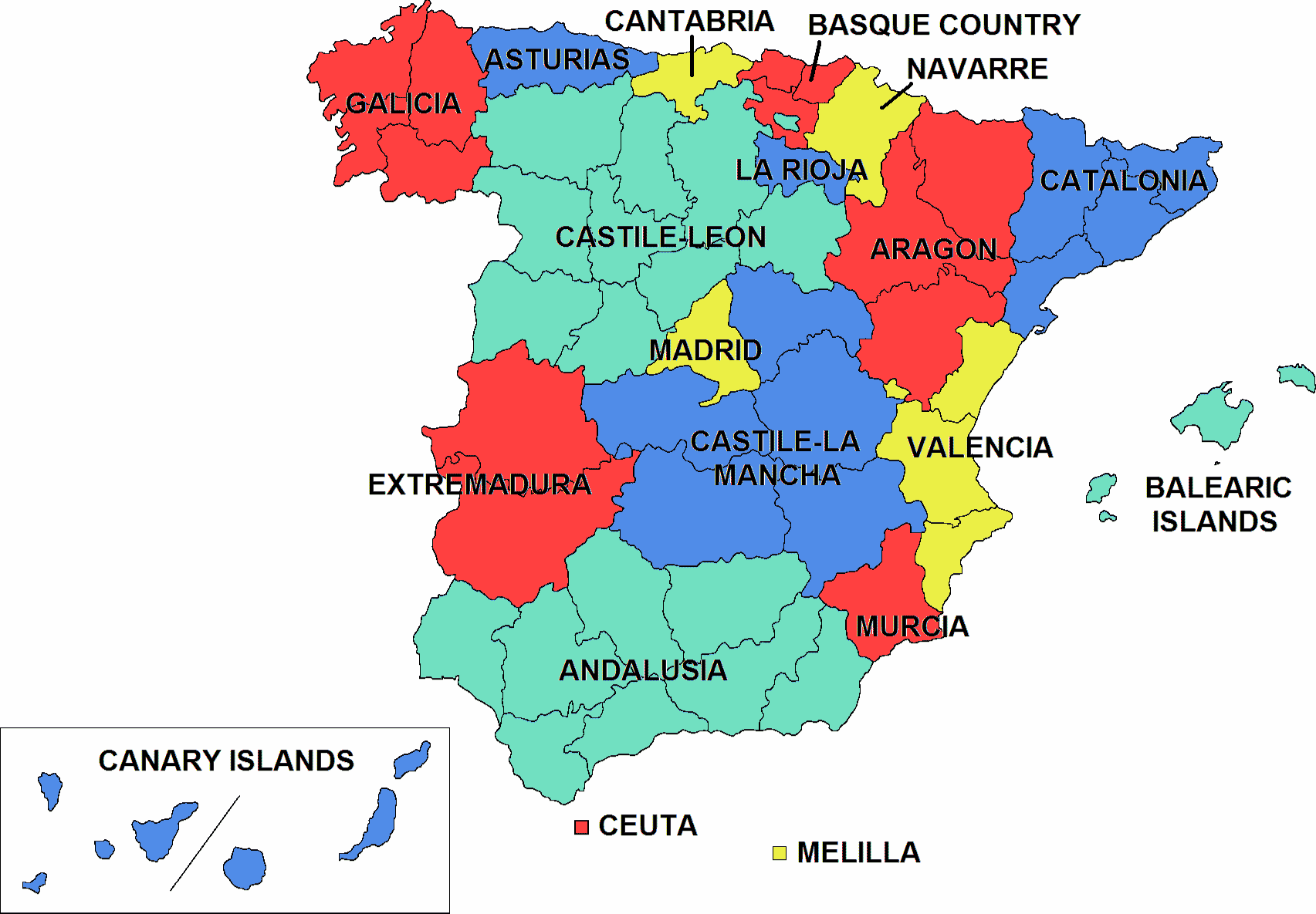
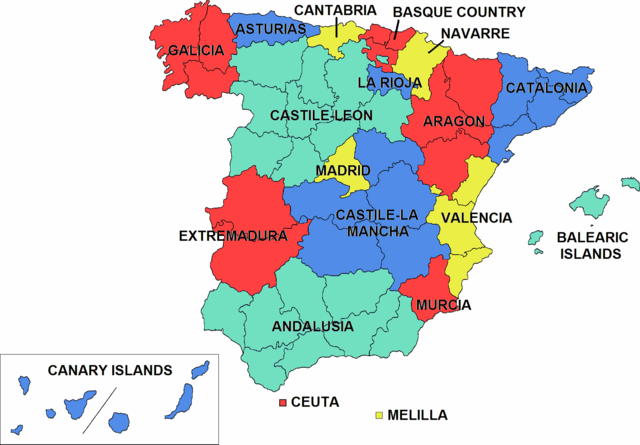
Coloured map of the autonomous communities of Spain. It was made using the image Provinces of Spain (Blank map).png.
Image and the text above was copied from en:Image:Ccaa-spain.png

|
Permission is granted to copy, distribute and/or modify this document under the terms of the GNU Free Documentation License, Version 1.2 or any later version published by the Free Software Foundation; with no Invariant Sections, no Front-Cover Texts, and no Back-Cover Texts. A copy of the license is included in the section entitled GNU Free Documentation License. |
| This file is licensed under the Creative Commons Attribution-Share Alike 3.0 Unported license. | ||
| ||
| This licensing tag was added to this file as part of the GFDL licensing update. |
derivative works
Derivative works of this file: Alarcia-in-spain.jpg
Taariikhda faylka
Riix taariikhda/waqtiga si aad u argto faylka sida oo ahaa markiisa hore.
| Taariikhda/Waqtiga | Sawir yar | Cabirka | Isticmaale | Ka hadalka | |
|---|---|---|---|---|---|
| kan hadda | 03:18, 25 Luuliyo ama Luulyo 2016 | | 1,705 × 1,185 (56 KB) | Rajzin | Greatly reduced the file size by removing unimportant color nuances. Made the green slightly lighter. |
| 03:10, 25 Luuliyo ama Luulyo 2016 |  | 1,705 × 1,185 (135 KB) | Rajzin | Changed the the green and blue colors to make the colors in the image easier to distinguish for colorblind people. Going by a colorblind simulation using Color Oracle, the yellow and green were almost indistinguishable for people suffering from deuter... | |
| 11:26, 19 Nofeembar 2013 |  | 1,705 × 1,185 (91 KB) | Quite vivid blur | Updated | |
| 19:39, 29 Abriil 2005 |  | 1,705 × 1,185 (126 KB) | BjørnN | Coloured map of the autonomous communities of Spain. It was made using the image ''Provinces of Spain (Blank map).png''. Image and the text above was copied from en:Image:Ccaa-spain.png {{GFDL}} |
Faylka lagu isticmaalay
waxyaabaha soo socda ee 2 boggag ayaa isticmaalaya faylkaan:
isticmaalka faylka aduunka
Wikisyada kale ee soosocda ayaa adeegsanaya faylka:
- Ku isticmaal be-tarask.wikipedia.org
- Ku isticmaal be.wikipedia.org
- Ku isticmaal cs.wikipedia.org
- Ku isticmaal cv.wikipedia.org
- Ku isticmaal en.wikipedia.org
- Centre for the Development of Industrial Technology
- User:Waninoco/My Gallery
- Nationalities and regions of Spain
- National and regional identity in Spain
- User:Jonny-mt/Gallery of current first-level administrative country subdivisions maps
- Politics of country subdivisions
- User talk:Jimbo Wales/Archive 145
- Ku isticmaal fa.wikipedia.org
- Ku isticmaal fi.wikipedia.org
- Ku isticmaal ga.wikipedia.org
- Ku isticmaal gv.wikipedia.org
- Ku isticmaal id.wikipedia.org
- Ku isticmaal jv.wikipedia.org
- Ku isticmaal krc.wikipedia.org
- Ku isticmaal lb.wikipedia.org
- Ku isticmaal ms.wikipedia.org
- Ku isticmaal pam.wikipedia.org
- Ku isticmaal ps.wikipedia.org
- Ku isticmaal pt.wikipedia.org
- Ku isticmaal ro.wikipedia.org
- Ku isticmaal rue.wikipedia.org
- Ku isticmaal scn.wikipedia.org
- Spagna
- Ìsuli Canarii
- Catalugna
- Ìsuli Baliari
- Galizzia (Spagna)
- Castigghia-La Mancia
- Paisi Baschi
- Navarra
- La Rioja
- Araùna (Spagna)
- Castigghia e León
- Andalusia
- Cumunitati autonumi di Spagna
- Template:Cumunità autònumi di Spagna
- Catigurìa:Cumunità autònumi di Spagna
- Cantabria
- Estremadura
- Asturi (cumunità autònuma)
- Madrid (cumunità autonoma)
- Murcia (cumunità autonuma)
View more global usage of this file.