File:Canada Manitoba relief location map.jpg

Cabirka muuqaalkaan: 486 × 599 pixels. Waxyaabaha kale xalinta: 195 × 240 pixels | 389 × 480 pixels | 623 × 768 pixels | 831 × 1,024 pixels | 2,184 × 2,692 pixels.
Faylka asalka ah (2,184 × 2,692 pixels, weyninka faylka : 2.61 MB, nuuca MIME: image/jpeg)
| Sharaxaad |
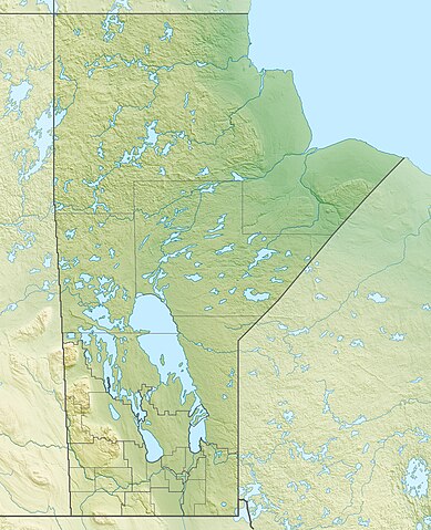
Quadratische Plattkarte, N-S-Streckung 170 %. Geographische Begrenzung der Karte:
Equirectangular projection, N/S stretching 170 %. Geographic limits of the map:
|
| Taariikhda | |
| Xigasho |
Shaqadayda, using
|
| Qoraa | Carport |
| Ogolaasho (Dib u isticmaalka faylkaan) |
This file is licensed under the Creative Commons Attribution-Share Alike 3.0 Unported license.
|
| Other versions |
|

Taariikhda faylka
Riix taariikhda/waqtiga si aad u argto faylka sida oo ahaa markiisa hore.
| Taariikhda/Waqtiga | Sawir yar | Cabirka | Isticmaale | Ka hadalka | |
|---|---|---|---|---|---|
| kan hadda | 17:09, 30 Nofeembar 2012 | | 2,184 × 2,692 (2.61 MB) | Carport | {{Information |Description= {{de|Physische Positionskarte von Manitoba, Kanada}} Quadratische Plattkarte, N-S-Streckung 170 %. Geographische Begrenzung der Karte: * N: 60.3° N * S: 48.7° N * W: 104.0° W * O: 88.0° W ... |
Faylka lagu isticmaalay
Ma jiraan bogag adeegsanaya faylkaan.
isticmaalka faylka aduunka
Wikisyada kale ee soosocda ayaa adeegsanaya faylka:
- Ku isticmaal ar.wikipedia.org
- Ku isticmaal ast.wikipedia.org
- Ku isticmaal ban.wikipedia.org
- Ku isticmaal bg.wikipedia.org
- Ku isticmaal ca.wikipedia.org
- Ku isticmaal de.wikipedia.org
- Winnipegsee
- Winnipegosissee
- Manitobasee
- Vorlage:Positionskarte Kanada Manitoba
- Wikipedia:Kartenwerkstatt/Positionskarten/Nordamerika
- Molson Lake
- Gods Lake
- Cedar Lake (Saskatchewan River)
- Tanco-Mine
- Whiteshell Provincial Park
- Nopiming Provincial Park
- Atikaki Provincial Wilderness Park
- Hecla-Grindstone Provincial Park
- Wasserkraftwerk Kelsey
- Southern Indian Lake
- Island Lake
- Cross Lake
- Playgreen Lake
- Sipiwesk Lake
- Granville Lake
- Dauphin Lake
- Oxford Lake
- Swan Lake (Manitoba)
- West Hawk Lake
- Big Sand Lake (South Seal River)
- Clearwater Lake (Cormorant Lake)
- North Knife Lake
- Pelican Lake (Pembina River)
- Pelican Lake (Pelican River, Manitoba)
- Cormorant Lake
- Nejanilini Lake
- Waskaiowaka Lake
- Commonwealth Lake (Manitoba)
- CKX-TV-Sendemast
View more global usage of this file.