File:Anvil shaped cumulus panorama edit crop.jpg
Faylka asalka ah (2,348 × 965 pixels, weyninka faylka : 477 KB, nuuca MIME: image/jpeg)
|
Qoraal kooban
| Sharaxaad | ||||||||||
| Xigasho | Shaqadayda | |||||||||
| Qoraa |
|
|||||||||
| Ogolaasho (Dib u isticmaalka faylkaan) |
|
|||||||||


| Camera location | | View this and other nearby images on: OpenStreetMap |
|---|
Laysinka
| ||||||||

|
Permission is granted to copy, distribute and/or modify this document under the terms of the GNU Free Documentation License, Version 1.2 only as published by the Free Software Foundation; with no Invariant Sections, no Front-Cover Texts, and no Back-Cover Texts. A copy of the license is included in the section entitled GNU Free Documentation License. | 1.2 only |
This file is published under the following Creative Commons license:
Attribution NonCommercial Unported 3.0 |
Taariikhda faylka
Riix taariikhda/waqtiga si aad u argto faylka sida oo ahaa markiisa hore.
| Taariikhda/Waqtiga | Sawir yar | Cabirka | Isticmaale | Ka hadalka | |
|---|---|---|---|---|---|
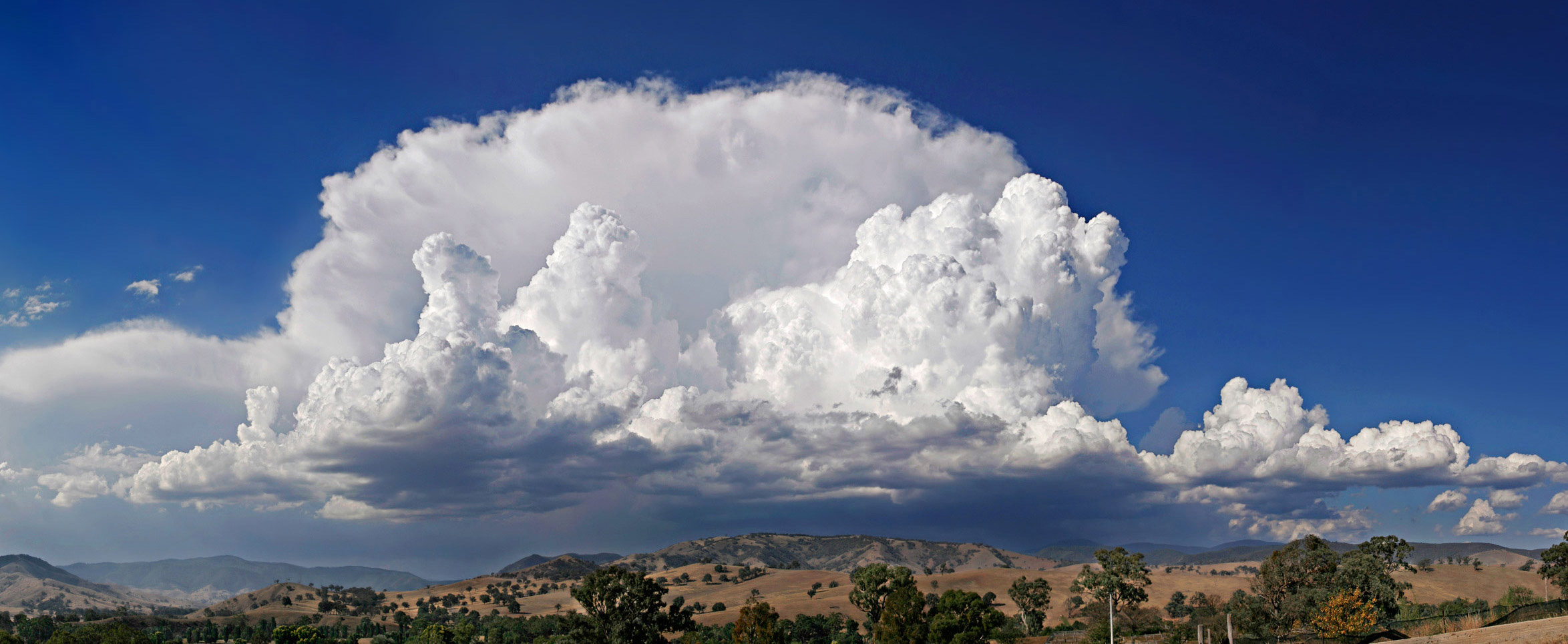
| kan hadda | 12:35, 26 Juun 2006 | 2,348 × 965 (477 KB) | Fir0002 | ''Cumulonimbus capillatus incus'' {{Fir0002 17}} Category:Clouds | |
| 11:46, 25 Juun 2006 | 2,348 × 965 (378 KB) | Fir0002 | ''Cumulonimbus capillatus incus'' {{Fir0002 17}} Category:Clouds |
Faylka lagu isticmaalay
waxyaabaha soo socda ee 2 boggag ayaa isticmaalaya faylkaan:
isticmaalka faylka aduunka
Wikisyada kale ee soosocda ayaa adeegsanaya faylka:
- Ku isticmaal af.wikipedia.org
- Ku isticmaal als.wikipedia.org
- Ku isticmaal an.wikipedia.org
- Ku isticmaal arc.wikipedia.org
- Ku isticmaal ar.wikipedia.org
- Ku isticmaal ast.wikipedia.org
- Ku isticmaal bcl.wikipedia.org
- Ku isticmaal beta.wikiversity.org
- Ku isticmaal bg.wikipedia.org
- Ku isticmaal bxr.wikipedia.org
- Ku isticmaal ca.wikipedia.org
- Ku isticmaal ca.wiktionary.org
- Ku isticmaal chr.wikipedia.org
- Ku isticmaal da.wikipedia.org
- Ku isticmaal de.wikipedia.org
- Wolke
- Portal:Umwelt- und Naturschutz
- Benutzer:Nils Simon
- Capillatus
- Benutzer:Mgloede
- Wikipedia:Kandidaten für exzellente Bilder/Archiv2006/11
- Portal:Umwelt- und Naturschutz/Willkommen
- Wikipedia:Einbänder/Abbildungen
- Datei:Screenshot-Portal-Umwelt-NaturschutzFirefox304-Mac.png
- Wikipedia:Kandidaten für exzellente Bilder/Archiv2010/6
- Benutzer:Merlissimo/KEB
- Wikipedia:WikiEule 2022
- Ku isticmaal el.wikipedia.org
- Ku isticmaal en.wikipedia.org
- Thunderstorm
- Lapse rate
- User:Fir0002/Fir0002 gallery/Featured Pictures
- User:Fir0002/Fir0002 gallery/20D/Scenery
- Wikipedia:Featured pictures thumbs/05
- User talk:Fir0002/Archive 3
- Wikipedia:Picture of the day/September 2006
- User:Fir0002/Fir0002 gallery/canon
- Wikipedia:Featured picture candidates/Anvil shaped cumulus panorama edit crop.jpg
- Wikipedia:Featured picture candidates/July-2006
- Wikipedia:Wikipedia Signpost/2006-07-10/Features and admins
- Wikipedia:Picture of the day/September 13, 2006
- Wikipedia:POTD/September 13, 2006
- Wikipedia:POTD column/September 13, 2006
- Wikipedia:POTD row/September 13, 2006
- User talk:Fir0002/Archive 7
- Portal:Geography/Featured picture/2007, week 4
- Portal:Weather/Selected picture archive
- Portal:Weather/Selected picture/4
View more global usage of this file.