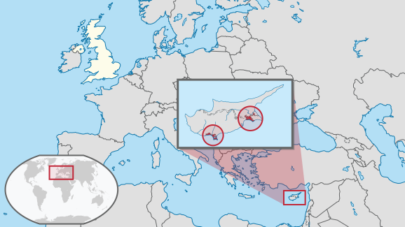
File:Akrotiri and Dhekelia in United Kingdom.svg

Size of this PNG preview of this SVG file: 578 × 325 pixels. Waxyaabaha kale xalinta: 320 × 180 pixels | 640 × 360 pixels | 1,024 × 576 pixels | 1,280 × 720 pixels | 2,560 × 1,439 pixels.
Faylka asalka ah (SVG file, nominally 578 × 325 pixels, file size: 6.97 MB)
Qoraal kooban
.svg)
.svg)
.svg)
.svg)
.svg)
.svg)
.svg)

-en.svg)

.svg)
.svg)
.svg)

_(US48).svg)
_(small_islands_magnified)_(-mini_map_-rivers).svg)
.svg)
_(extra_close)_(US48).svg)
.svg)
_(zoom).svg)

.svg)


_(UNMIK).svg)
.svg)
_(disputed_hatched).svg)
_(claimed_and_disputed_hatched).svg)
.svg)
.svg)
_(%2Ball_claims_hatched).svg)

.svg)
_(shade).svg)
_(shade)_(special_marker).svg)
_(-mini_map).svg)
_(-mini_map).svg)
_(-mini_map).svg)


.svg)

.svg)
Laysinka
I, the copyright holder of this work, hereby publish it under the following licenses:

|
Permission is granted to copy, distribute and/or modify this document under the terms of the GNU Free Documentation License, Version 1.2 or any later version published by the Free Software Foundation; with no Invariant Sections, no Front-Cover Texts, and no Back-Cover Texts. A copy of the license is included in the section entitled GNU Free Documentation License. |
This file is licensed under the Creative Commons Attribution-Share Alike 3.0 Unported license.
- Waad fasaxantahay:
- la wadaagid – koobi gareenta, qaybinta iyo gudbinta shaqada
- to remix – in shaqada la waafajiyo
- Shuruudaha soo socda:
- Astaan – You must give appropriate credit, provide a link to the license, and indicate if changes were made. You may do so in any reasonable manner, but not in any way that suggests the licensor endorses you or your use.
- si isku mid la wadaag – If you remix, transform, or build upon the material, you must distribute your contributions under the same or compatible license as the original.
You may select the license of your choice.

|
I'd greatly appreciate, that you attribute this media file to Wikimedia Commons, if used outside Wikipedia or Commons. For use in publications such as books, newspapers, blogs, websites, please insert here the following line:
|
Taariikhda faylka
Riix taariikhda/waqtiga si aad u argto faylka sida oo ahaa markiisa hore.
| Taariikhda/Waqtiga | Sawir yar | Cabirka | Isticmaale | Ka hadalka | |
|---|---|---|---|---|---|
| kan hadda | 12:43, 5 Agoosto 2011 | | 578 × 325 (6.97 MB) | TUBS | {{Information |Description={{de|Lage des Überseegebietes XY (siehe Dateiname) im Vereinigten Königreich.}} {{en|Location of overseas territory xy (see filename) in the United Kingdom.}} |Source={{o |
Faylka lagu isticmaalay
Ma jiraan bogag adeegsanaya faylkaan.
isticmaalka faylka aduunka
Wikisyada kale ee soosocda ayaa adeegsanaya faylka:
- Ku isticmaal an.wikipedia.org
- Ku isticmaal ar.wikipedia.org
- Ku isticmaal ast.wikipedia.org
- Ku isticmaal az.wikipedia.org
- Ku isticmaal ba.wikipedia.org
- Ku isticmaal be.wikipedia.org
- Ku isticmaal bg.wikipedia.org
- Ku isticmaal bn.wikipedia.org
- Ku isticmaal ca.wikipedia.org
- Ku isticmaal cs.wikipedia.org
- Ku isticmaal da.wikipedia.org
- Ku isticmaal diq.wikipedia.org
- Ku isticmaal en.wikipedia.org
- Ku isticmaal eo.wikipedia.org
- Ku isticmaal es.wikipedia.org
- Ku isticmaal es.wikivoyage.org
- Ku isticmaal fi.wikipedia.org
- Ku isticmaal ga.wikipedia.org
- Ku isticmaal gl.wikipedia.org
- Ku isticmaal he.wikipedia.org
- Ku isticmaal hi.wikipedia.org
- Ku isticmaal ilo.wikipedia.org
- Ku isticmaal it.wikipedia.org
- Ku isticmaal ja.wikipedia.org
- Ku isticmaal kk.wikipedia.org
- Ku isticmaal km.wikipedia.org
- Ku isticmaal la.wikipedia.org
- Ku isticmaal ml.wikipedia.org
- Ku isticmaal ms.wikipedia.org
- Ku isticmaal my.wikipedia.org
- Ku isticmaal nl.wikipedia.org
- Ku isticmaal no.wikipedia.org
- Ku isticmaal or.wikipedia.org
- Ku isticmaal pa.wikipedia.org
- Ku isticmaal pnb.wikipedia.org
- Ku isticmaal pt.wikipedia.org
View more global usage of this file.